This is indeed an interesting hike: depending on your pace, it can go from a beginning level to a really advanced one. But it is worth it, at least you are not going to queue to get on top with the lower cable way!
Name: Table Mountain Maclear’s Beacon via Platteklip Gorge
Difficulty: Medium
Terrain: Steep ascent with big rocks, but an easy 30 mins walk in the last part.
Ascent time: 2h30 mins with a medium pace
Descent time: 1h45 mins with a medium pace
Distance: around 8.2 km back and forth
To do before/to bring:
- To do: check via a live webcam if there are clouds on top (or if they are approaching). You can find a good webcam by clicking here.
- To bring: usually it’s really windy up there and clouds can approach fast.
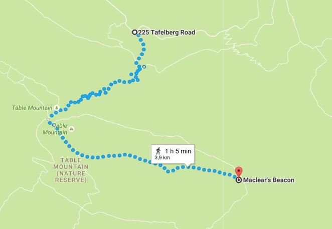
The Hike starts at the Platteklip Gorge signal on Tafelberg road, straight after the lower cable station. There is a parking where you can leave your car and start your walk.
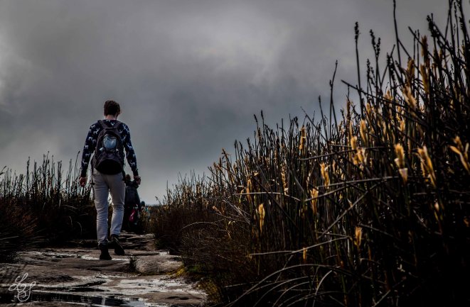
Don’t rush after the start – preserve your energy: it’s going to be steep! The first part is on a well maintained path, but after you will pass Devil’s peak turn, you will go right and you will start your real ascent: the steepness is felt even more because of the path, not always that easy because of big uneven rocks and sharp turns.
The more you’ll go up, the better the view will be.
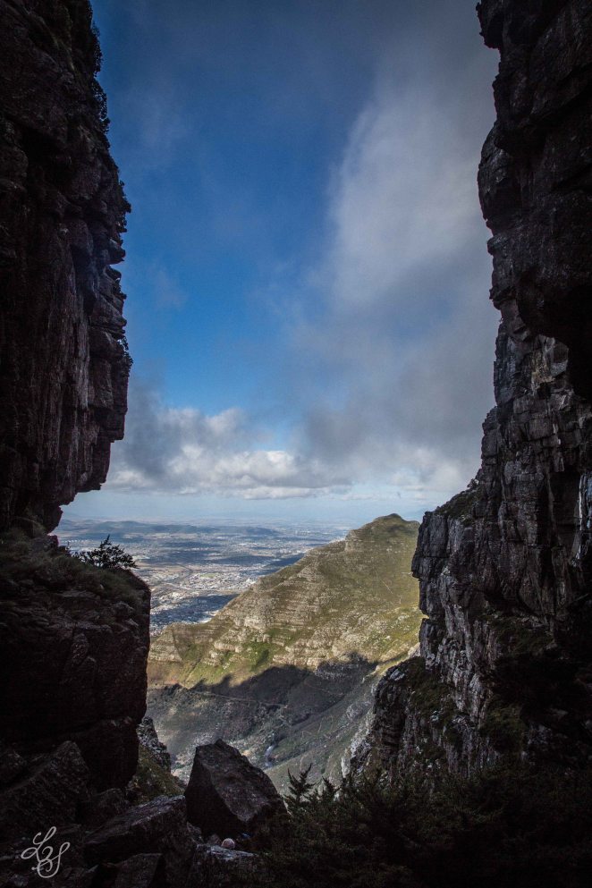
From a certain height, you’ll see a break in the rocks where your path is leading: that’s the Gorge, magnificent. But before getting there, you will get up around 600 mt in less than 2km, which means that it is quite an ascent.
The view from the Gorge is totally worth it.
After the Gorge, you will arrive to a point where you will be able to choose different paths:.
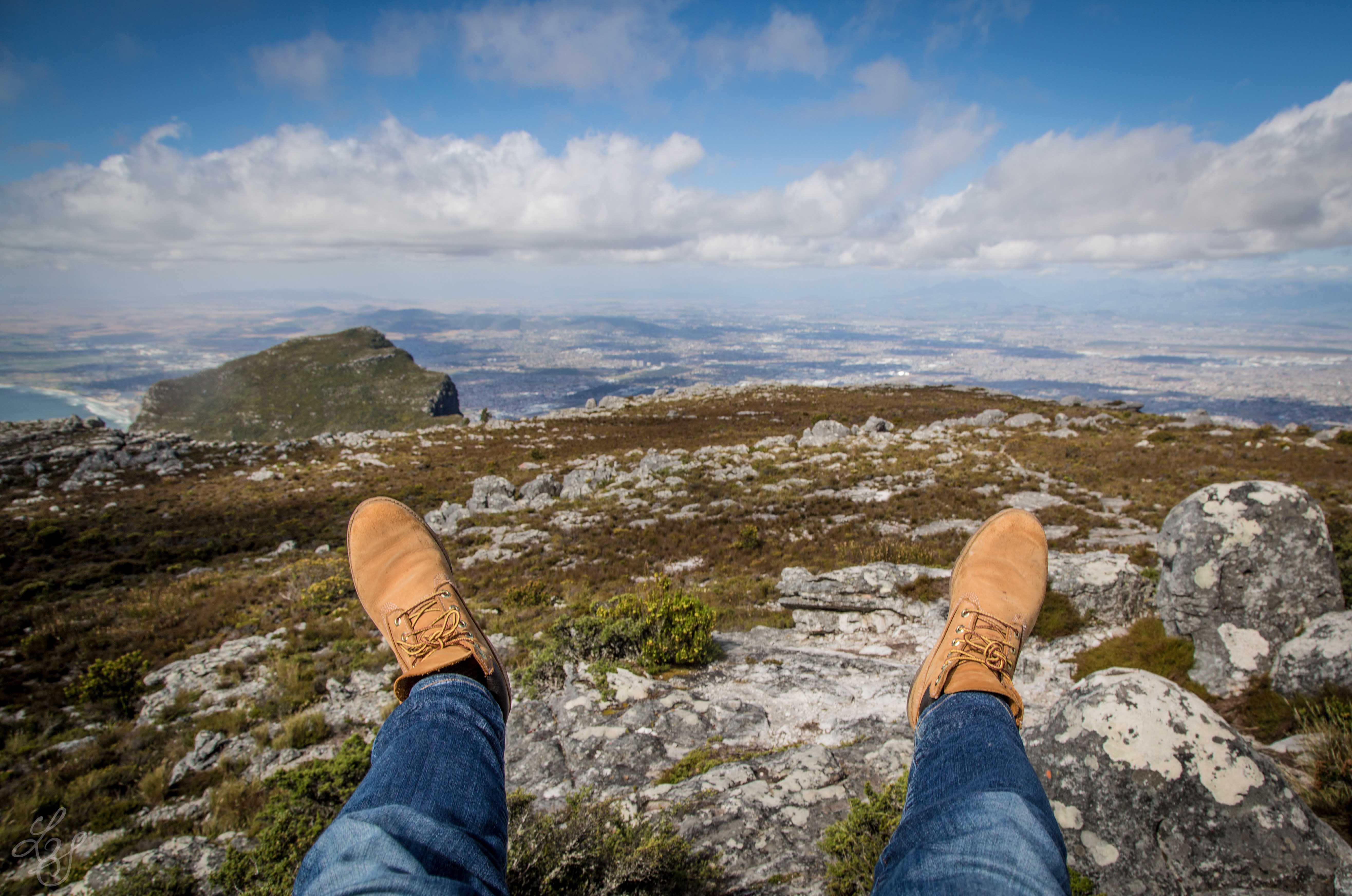
- Go left to follow Maclear’s Beacon, the highest point on Table mountain (1086 mt asl – around 30 min at a medium pace) – we are going to follow this route;
- Go Right to reach the upper cable station for an easy descent and some great views over Camps Bay and Lion’s Head (around 15 min).
- Go straight to reach the lakes formed by the dome (around 1h).

Taking the left, it’s an easy walk on a straight path till the highest point on Table Mountain. It’s around 2km far from this point and the elevation gain is no more than 30 meters. Easy enough to even spend some time in the area making photos.
Once you reached the beacon, a bit of history is due: made in 1865 by Sir Thomas Maclear, it wasn’t made for height, it was made for a more interesting purpose: indeed, he was trying to measure the curvature of earth. You want to know more? Click here!

The view from the beacon is simply fantastic. Devil’s peak seems so little in front of Table Mountain and you have an almost 360 degrees view on Cape Town, from Lion’s Head till Muizenberg. I recommend you to bring up a bottle of red wine with you to better enjoy the scenery, but hey – remember you still need to come down (and you must bring all the trash back with you. Respecting the mountain, right?).
Therefore, after a break, some photos and thoughts, get your backpack and walk back to either an easy descend (upper cable way, R125 pp) or a more challenging one. Be aware in the latter case: the red rocks are generally very slippery!
Have a great hike!
